

X43A
Marvell, AR, USA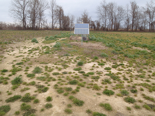
The USArray component of the NSF-funded EarthScope project ended its observational period in September 2021 and all remaining close-out tasks concluded in March 2022. Hundreds of seismic stations were transferred to other operators and continue to collect scientific observations. This USArray.org website is now in an archival state and will no longer be updated. To learn more about this project and the science it continues to enable, please view publications here: http://usarray.org/researchers/pubs and citations of the Transportable Array network DOI 10.7914/SN/TA.
To further advance geophysics support for the geophysics community, UNAVCO and IRIS are merging. The merged organization will be called EarthScope Consortium. As our science becomes more convergent, there is benefit to examining how we can support research and education as a single organization to conduct and advance cutting-edge geophysics. See our Joining Forces website for more information. The site earthscope.org will soon host the new EarthScope Consortium website.

By Maia ten Brink
Popular Science magazine calls EarthScope the most epic science experiment in the universe, with 2,000 earthquake sensors covering eight million square kilometers of the continental United States. How did the EarthScope team deploy the massive “USArray” in just 10 years? It was a multistage process, but the very first step was finding suitable sites. Somebody had to track down civilians willing to lend their private land to the experiment and make certain that those locations would provide high-caliber seismic data. That somebody was Graylan Vincent. At twenty-five, the Incorporated Research Institutions for Seismology (IRIS) hired Vincent to zigzag around the country in a dusty pickup truck with an EarthScope t-shirt, an eager handshake, and a business card that read: “Graylan Vincent, Reconnaissance Specialist.”
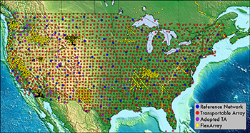
Location map of the ~2,000 Transportable Array
(red dots) deployed over 10 years.
The title befits a secret agent, but Vincent describes himself as a land permitting specialist whose goal was finding sites that would provide quality recordings of earthquakes deep beneath Earth’s surface. Seismometers are a little too sensitive for their own good. They not only pick up earthquakes, but also minuscule vibrations—ground shifts when the temperature changes, trees leaning in the wind, cars passing—and distant noise sources such as hydroelectric dams, trains, tractors, oil pipelines, ocean waves pounding on the shore, and the drone of ships’ engines. These other sounds obscure the vibrations from earthquakes. The geoscientists running the EarthScope experiment therefore wanted to ensure that the sound waves that each seismometer registered were truly earthquakes, not artifacts caused by other noise sources.
First Vincent needed to know where not to place seismometers. He consulted specially created geographic information system (GIS) maps that ruled out areas that were too close to noise sources like highways, railroads, waterways, and large

Suitability map showing one circular region of interest in Massachusetts.
The map is shaded according to how many criteria for a site are met.
Red is none, yellow is 1 criterion, and green outline is 2 criteria.
towns. These suitability maps were covered in an even grid of circles spaced 70 kilometers apart, indicating 250-square-kilometer regions where the seismometers had to be stationed. Opaque red swaths on the maps meant that the land was unsuitable, while white areas meant “good to go.” Sometimes the entire circular region was awash in a tide of red. Vincent said that the Southwest proved the most challenging area to site. It was easier and faster to get permission to use private land than public land, but finding private landowners in states like Utah, where 70% of land belongs to the federal or state government, involved considerable detective work using Google Earth and the state land registry.
Seismometers had to be several dozen meters from trees, at least 1.5 kilometers away from major roads, but close enough so that construction crew could drive in a backhoe to dig a hole in which the seismometer would be buried. Siting in densely-populated, forested New England was a headache of an optimization problem. Likewise, Vincent had to balance remote location with cellular coverage. The seismometers sent real-time seismic data over cellular networks to a data collection and analysis center at the University of California, San Diego. Reconnaissance was truly an art of compromise.
It also involved rhetorical skill. Imagine being a traveling salesman nowadays, in the era of do-not-call lists. Now imagine you’re not selling anything, but asking people to do you a favor in the name of science. Vincent still seems slightly astonished that it actually worked.
One of the reasons for its success was the student siters. As the array progressed across the country from west to east, EarthScope began hiring local university students to do reconnaissance during their summer breaks. Vincent followed behind, double-checking the quality of the students’ sites and getting landowners’ written permission. Sometimes, in the months since the students had visited, landowners had rotated their crops and covered the chosen site in corn, sold their property, changed their minds, forgotten that they had agreed to participate, or even died. Vincent cleaned up any misunderstandings, moving from north to south, from summer until snow obscured the ground he was siting on.
There was no perfect strategy to find willing participants, but many of the student siters benefitted from making local contacts. In Vermont, Boston College senior Alissa Kotowski found that she could tap connections between dairy farmers and ask them to recommend other sites. Catherine Cox, then a graduate student at the University of Oklahoma, partnered with the Department of Agriculture’s conservation districts, which are county subdivisions in Oklahoma that help citizens with resource use and management. James Taylor, from Auburn University, located several sites through the Alabama Cattleman’s Association. Michigan State student Ben Johnson appealed to college connections, but mainly relied on the old door-to-door technique.
In rural America, an unfamiliar figure driving around your fields tends to signal “up to no good.” Student siters would mention that they came from the local university; Vincent, unfortunately, raised suspicion as soon as he pulled up in a
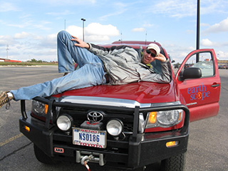
Graylan Vincent posing for photo on his truck.
truck with government plates. People would query, “Do you work for Mr. Obama?” or “Are you tapping my phone?” He estimated that, throughout the US, about 25% of his initial contacts worked out. That number varied immensely depending on region and circumstance. People on the West Coast were far more enthusiastic about earthquake research because they felt directly affected; in New England, however, Kotowski and another student siter had to visit at least ten potential sites for each circular region of interest.1 “We might get one or two yeses, and if we were lucky one of those might be good for a sensor,” she said.
Vincent recited his pitch at least 800 times during his eight years of reconnaissance. He said, “It’s kind of weird that such a unique project and such a unique experience for the landowners became such a routine thing for me that, by the end, I didn’t even have to think about answering their questions.”
In the highest and lowest latitudes of the USArray, however, language barriers sometimes thwarted reconnaissance efforts. Vincent said that a student from Paris siting in southern Quebec couldn’t understand many of the landowners’ heavy Québecois accents — “which made me feel good, because I can’t understand a word they said, even though I took French for eight years.” Vincent wished he’d studied Spanish instead. He once chased down a school bus in south Texas in hopes that the driver knew English. In Logan, Utah, Vincent came across a lone individual who was tending to cattle. “He was the only person around for miles. He only spoke Spanish and I only spoke English. I just couldn’t make it work.”
Although landowners generally expressed curiosity about the EarthScope experiment, a few were outright hostile. In southeastern Oklahoma, Catherine Cox and her
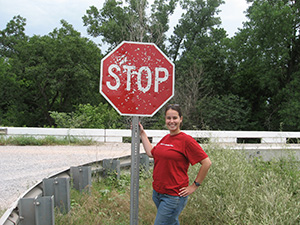
Catherine Cox next to a shot-up stop sign in Oklahoma.
siting partner pulled up to a house with a long driveway, and as they started walking down it, “We didn’t really follow our gut instincts,” said Cox. “We just kind of kept walking, and the landowner threatened us to get off her property. She was screaming at us and went to grab a rifle to chase us off.” The two young women turned tail and ran. From that point on, she used the conservation districts and third party connections to procure sites instead of knocking on random doors.Another time, Cox was searching for a site in the Ouachita Mountains, Five employees from the county conservation district had to escort Cox and her partner in order to find a site. “I definitely saw more of Oklahoma than I think I ever needed to see,” she said.
In an affluent suburb of Washington, DC, Vincent stepped out of his truck to deliver his usual pitch. A man came outside with what seemed to be a handgun held behind his back.
“Hi, my name is Graylan and I do earthquake research,” said Vincent. He was wearing his EarthScope shirt. “I’m out here looking for someplace to put an earthquake sensor for a research project.”
“You got any ID?” the man asked. Vincent showed him his business card and driver’s license. Then the man laid him over the hood of his truck, holding his wrists in a handcuff.
“Are you kidding me?” asked Vincent. The man said no.
“I’m sorry that I bothered you. I think I should leave,” Vincent said, attempting to disengage.
“No, I think you should stay. I don’t think you should go anywhere.”
Vincent continued to protest, and at last the man seemed to realize that EarthScope was no ruse. Finally he released Vincent, explaining that there had been a spate of recent break-ins involving someone with a pickup.
“You shouldn’t be going around with your truck knocking on doors,” the man advised.
“Well, that’s what I do. I don’t really have a choice,” Vincent said wryly.
The man’s wife called Vincent that evening to apologize, and the couple ended up hosting a site.
“I had some rough ones, but there’s no site that went un-done,” said Vincent. “FBI or US marshals, they always get their man. I kind of feel the same way.”
__________
1When Kotowski mentioned earthquakes, New Englanders usually laughed at her. In fact, New England has experienced eleven earthquakes in the last 150 strong enough to crack chimneys, damage homes, and warp roads. Most earthquakes in New England are just too small for humans to feel.

