

O02D
Mt. Diablo Meridian, CA, USA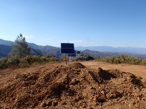
The USArray component of the NSF-funded EarthScope project ended its observational period in September 2021 and all remaining close-out tasks concluded in March 2022. Hundreds of seismic stations were transferred to other operators and continue to collect scientific observations. This USArray.org website is now in an archival state and will no longer be updated. To learn more about this project and the science it continues to enable, please view publications here: http://usarray.org/researchers/pubs and citations of the Transportable Array network DOI 10.7914/SN/TA.
To further advance geophysics support for the geophysics community, UNAVCO and IRIS are merging. The merged organization will be called EarthScope Consortium. As our science becomes more convergent, there is benefit to examining how we can support research and education as a single organization to conduct and advance cutting-edge geophysics. See our Joining Forces website for more information. The site earthscope.org will soon host the new EarthScope Consortium website.

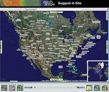 As the Transportable Array continues its journey from the west to east, you might want to determine if your property is close to a potential station site and to submit your site details. You can do this by going to our Suggest a Site web page.
Zoom to a place by entering an address, a zip code, a city and state (City, State), or a latitude and longitude (xx, yy) in the box at the top of the map and then click the "Zoom to Location" button. Or you can use the zoom and directional tools at the bottom of the page to go directly to your location of interest.
The map shows where future stations will be located or where current stations are installed. Just click on a red balloon-shaped marker (a station that is operating or being constructed) or a blue balloon-shaped marker (a future station) for more information. As you zoom in on an area, the blue markers are replaced with blue circles to indicate the area within which a future station will be placed.
To suggest a site, use the "marker" tool to identify the suggested location on the map. To activate the "marker," click the labeled icon with the green balloon on the bottom left-hand side of the page. Placing a marker will automatically open the site suggestion form, which will slide open on the right-hand side of the map. Or you can click on the "Show Panel" tab, located in the upper right corner of the map to display the site suggestion form. Next, fill in the required information (denoted with an *) on the site suggestion form and click the "Send your Suggestion to EarthScope" button at the bottom of the form. Only locations within the blue circle—or buffer zone—will be accepted. The information you enter will be sent to the Transportable Array Coordinating Office in Socorro, New Mexico, for consideration.
The "Suggest A Site" application, developed by IAGT for EarthScope, is updated weekly with current data and offers a fun and convenient way to explore our network of Earthquake Monitoring Stations.

