

P49A
Miami Univ. Ecology Research Center, OH, USA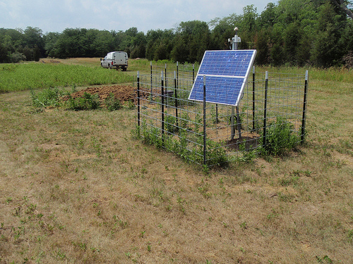
The USArray component of the NSF-funded EarthScope project ended its observational period in September 2021 and all remaining close-out tasks concluded in March 2022. Hundreds of seismic stations were transferred to other operators and continue to collect scientific observations. This USArray.org website is now in an archival state and will no longer be updated. To learn more about this project and the science it continues to enable, please view publications here: http://usarray.org/researchers/pubs and citations of the Transportable Array network DOI 10.7914/SN/TA.
To further advance geophysics support for the geophysics community, UNAVCO and IRIS are merging. The merged organization will be called EarthScope Consortium. As our science becomes more convergent, there is benefit to examining how we can support research and education as a single organization to conduct and advance cutting-edge geophysics. See our Joining Forces website for more information. The site earthscope.org will soon host the new EarthScope Consortium website.

Principal Investigators and Institutions:
John Hole, Virginia Polytechnic Institute
Joann Stock, California Institute of Technology
Gary Fuis, USGS- Menlo Park
Funding Source:
Marine Geology and Geophysics
Field Dates:
2/2011 – 3/2011
Equipment Used:
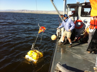
2600 TEXANS
Data Status:
Archive in Progress
Assembled ID:
11-012
Description:
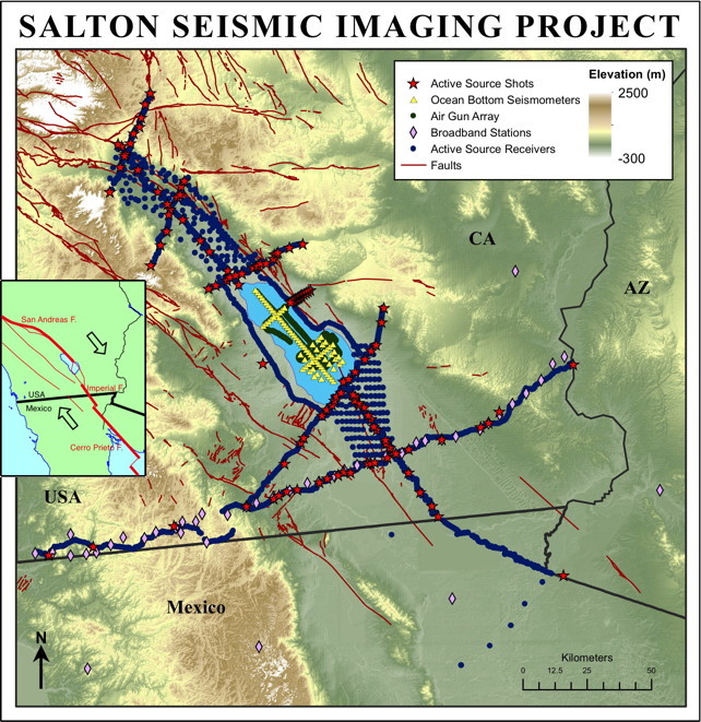
The project will address the processes of rupturing of continental lithosphere through seismic reflection and refraction survey of the Salton Trough. This is an ideal location to study the effect of magmatism and sedimentation on continental extension and the portioning of the strain vertically in the lithosphere. The objectives of the study are to investigate the nature of the transitional crust at rifted continental margins; the role of magmatism in final stages of breakup; the effect of synrift sedimentation on magmatism and extension mechanism; the portioning and displacement in highly oblique continental rifting; and 3D structure for earthquake hazard evaluation.
The broader impacts include addressing important goals of the MARGINS RCL initiative and contribute towards the goals of Earthscope as well as GeoSwath initatives. It uses Earthscope instrumention. It will foster strong collaboration between MARGINS, Earthscope and USGS, and involve undergraduate and graduate students in the field experiment. It will also incorporate the experiment into a graduate level course, and involve students in the interpretation of the data once it is collected.
Publications/ Abstracts
Feng, H. S., J. A. Hole, G. S. Fuis and J. M. Stock. "Designing shots for the 2010 seismic refraction and reflection survey in the Salton Trough, southern California," EOS Trans. AGU, Fall Mtg. Suppl., Abstr. T11A-1846, v.89, 2008.
Hole, J. A., J. M. Stock, and G. S. Fuis. "Controlled-source seismic imaging of rift processes and earthquake hazards in the Salton Trough," EOS Trans. AGU, Fall Mtg. Suppl., Abstr. S11C-1760, v.89, 2008.
Hole, J. A., Stock, J. M., Fuis, G. S., Rymer, M. J., Murphy, J. M., Sickler, R. R., Criley, C. J., Goldman, M. R., Catchings, R. D., Ricketts, J. W., Gonzalez-Fernandez, A., Driscoll, N. W., Kent, G. M., Harding, A. J., and Klemperer, S. L.. "The Salton Seismic Imaging Project (SSIP): Rift processes and earthquake hazards in the Salton Trough," EOS Trans. Amer. Geophys. Union, Fall Meeting Suppl., Abstract T31A-1790, v.90, 2009.
Murphy, J. M., Rymer, M. J., Fuis, G. S., Stock, J. M., Goldman, M., Sickler, R. R., Miller, S. A., Criley, C. J., Ricketts, J. W, and Hole, J. A.. "Calibration shots recorded for the Salton Seismic Imaging Project, Salton Trough, California," EOS Trans. Amer. Geophys. Union, Fall Meeting Suppl., Abstract T31A-1791, v.90, 2009.

